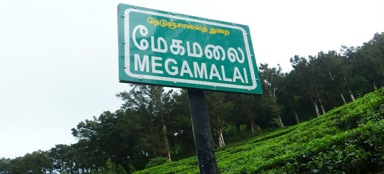
Megamalai at a Glance
In Tamil it is known as" Paccha Kumachi" meaning "Green Peaks" High Wavys'is locally referred to as Meghamalai- meaning hills covered with clouds.
The word 'High Wavys', used since the late 1920's invariably has been derived to describe the high undulating range of hills and mountains, steep and precipitous as seen from the plains. .
Geographically High Wavys' forms part of the Varushanad Range of hills, a part of the Western Ghats.
Probably the earliest reference of High Wavys'is in the British Imperial Gazetteer Maps which dates back to 1920. The location was very approximate in the said maps, when land was being surveyed for Cinchona plantations by Messrs. E. Blatter and Prof. F.Hallberg. The essence of all the information derived from these maps, in the gazetteer's own words: .
"The High Wavys'is the least known part of the hills of Madurai, and is infested with elephants and is the source of the Shurily river overrun with dark impenetrable forest" namely as Madras Tea Estate. .
Pioneers to these mountains needed to wade through knee to chest deep water before undertaking a steep 10 mile trek through thick and dense Jungle.
Destination
Welcome to Magamalai wild life sanctuary & High wayvs. Xenia focus on Tourism initiatives projects specified in less known tourism destination in guidelines with Government of Tamilnadu.
Megamalai:
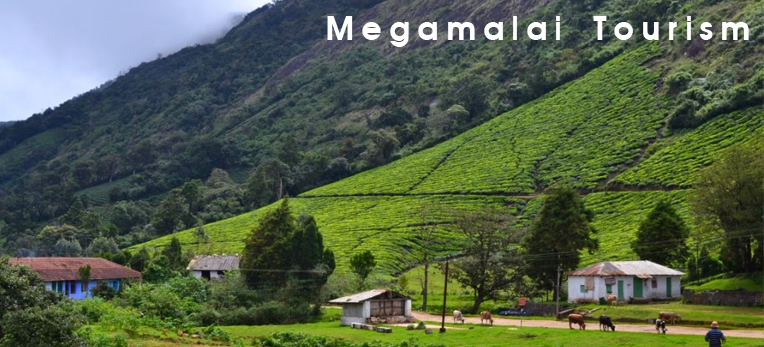
As the name suggests, Megamalai is the kingdom where the clouds meet the mountains. It is arguably the most beautiful hill station in South India, known to a selective few and seen by even fewer people. This lovely place is bound to capture your imagination. Good place to stay and enjoy a lovely surrounding. One can also watch the animals roaming in the forests, which are close to Megamalai,
Megamalai, popularly called High Wavys Mountains, is a cool and misty mountain range situated in the Western Ghats in Theni district, Tamilnadu, India. It is a place of natural beauty dotted with cardamom plantations and tea estates. The place is situated at an elevation of 1,500 m above sea level and it is rich in flora and fauna.
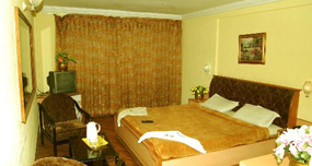
Megamalai a 6000 acre tea plantation is located in Tamil Nadu about 43 kms off Chinnamanoor, on the Madurai - Kumili Interstate Highway. Today Meghamalai has become the cynosure of every tourist. The approach via Chinnamannur is more scenic. Only forest lodges and rest house are available at the hill top. Prior reservation and permission is an absolute must. For reservation contact 9894055554
HighWays
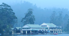
The Highwavys panchayat has a number of attractions like Manalar, Venniyar and Iravangalaru dams, Megamalai estate and Maharajamettu, where tourists view vast catchments of Thekkadi dam, Magarajothi hill of Sri Iyyappan temple and a bird's eye view of Theni district.
Vellimalai:
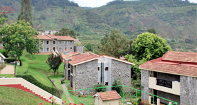
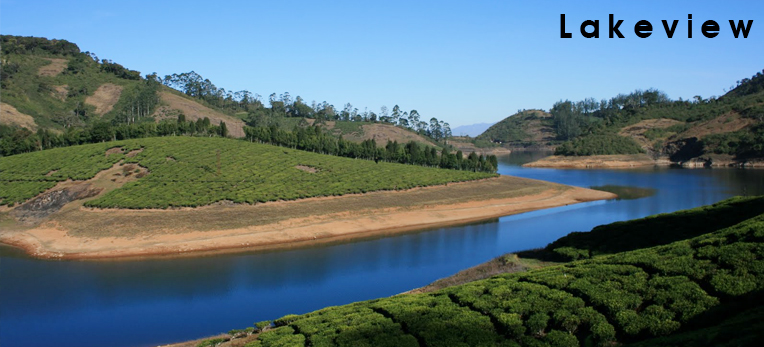
At an altitude of 1650 m, Vellimalai forms the heart of Meghamalai. Silver-lined clouds gently resting on green hilltops is a common sight here. This region is also the abode of river Vaigai. The hill range also provides a wonderful view of the entire range of Varusanadu Hills. With tea and coffee estates, houses of plantation workers and an artificial lake, there is plenty of scope for enjoying the natural beauty.
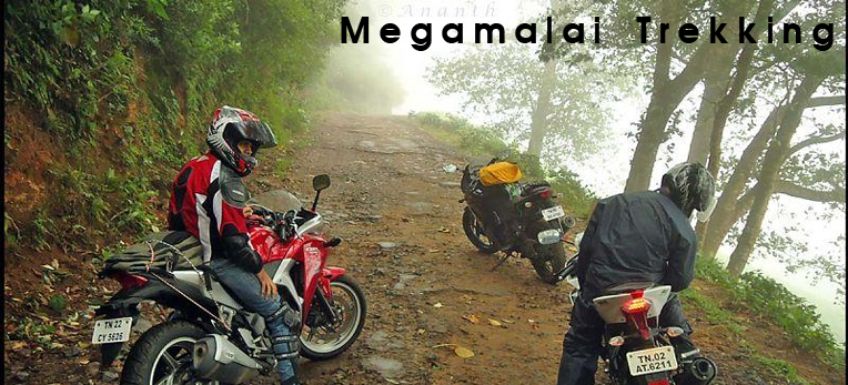
Sight Seeing / Trekking
- Highwayvs Dam
- Highwayvs Lake
- Manalar Dam
- Deep Cumbum Valley and the villages
- Upper Manalar Estate
- Vattaparrai
- Venniyar Tea Estate
- Iravagalar Dam
- Maharaja Mettu - A bird's eye view
- Magarajothi hill View of Sri Iyyappan temple.
- Thekkadi View point
- Elephant Corridor -amazing point
- pothai pull medu
- Megamalai rain forest
- Manalar Water falls
- Thoovanam
Megamalai Tourism: for Reservation call 94878 50508
- Forest Jeep Safaris - Drive across the plantation to see animals - Rs.1000 for 2 pax
- Tea Estate Tour - Drive across the plantation - Rs.1000 for 2 pax
- Picnic at Grass Hills - Rs.1000 for 2 pax
- Cycling - Rs.50 per Hour
- Trekking Rs.1000 per Trip
- Bathing in a natural waterfall